
Open 24 hours · on site within 2 hours2-hour response
Mamaroneck Flood Damage Restoration, From Pump-Out to Rebuild
Two rivers, a brook and Long Island Sound meet in the Village of Mamaroneck, and Ida flooded 535 homes there. Strongwater is based about two road miles away in Harrison.
Get a Free Estimate
Tell us what happened and we'll call you back. In a hurry? Call (718) 357-9191.
- Free estimates
- Open 24 hours
Mamaroneck, NY
Who restores flood-damaged homes along the Mamaroneck and Sheldrake rivers?
Our crews at Strongwater Restoration handle the whole job: pumping, tear-out, drying and the rebuild. The office at 111 Calvert Street in Harrison is 2.2 road miles from Mamaroneck Village Hall, and we work across the village, Rye Neck and the unincorporated town, in houses, condos and apartment buildings alike.
The village’s housing is old and varied. Census Bureau estimates for 2020-2024 put its median construction year at 1953, with 38.1% of units built before 1940, 78.4% before 1980 and 18.3% in buildings of 20 or more units. The Town of Mamaroneck as a whole is older still, at a 1945 median. The village flood handbook tells residents to bring in trained contractors if they suspect asbestos after a flood, and asbestos abatement is one of our services.
Housing: U.S. Census ACS 5-year estimates. Distance is approximate.
About Mamaroneck
Why does the Village of Mamaroneck flood so badly?
So much water converges there. The village’s 2024 Flood Preparedness Handbook places it where the Mamaroneck River, the Sheldrake River and Beaver Swamp Brook meet a 250-acre underground aquifer and Long Island Sound. The Army Corps adds low channel capacity, small bridge openings and poor flow where the two rivers join.
Ida showed the cost. The village’s handbook counts 14 feet of reported flooding, 535 flooded homes, 150 people displaced, 1,000 water rescues and $75 million in residential and commercial damage. The USGS gauge on the Mamaroneck River in the village peaked at 12.92 feet on September 2, 2021, the highest in its annual-peak record and above the 11.50 feet of September 21, 1938 (USGS peak record).
The larger fixes are years out. The Army Corps’ Mamaroneck and Sheldrake Rivers project, authorized in 2018 with a first cost of $127.4 million in 2024 prices, is still in design: the Ward Avenue bridge replacement is being designed in full, with the remaining design and the partnership agreement expected in 2028 (USACE fact sheet). Nearer to finished, a roughly $2.5 million, mostly FEMA-funded drainage project on Wood Street and part of Jefferson Avenue is substantially complete.
In the unincorporated town, engineers have grouped 17 flood-prone areas into 13 subbasins, pulled more than 51 tons of debris and roots from the storm sewers, and expect construction in three subbasins to begin by early 2027. The state’s Beaver Swamp Brook study adds the Continental View Condominiums in the village to its high-risk areas. After the September 13, 2026 flash flooding, the village announced SBA disaster loans, with a December 1, 2026 deadline for physical damage.
Permits & rebuilding
Which permits does a flood rebuild in the Village of Mamaroneck need?
Usually several. The village’s flood handbook lists floodplain development, building (which covers mechanical work), plumbing, electrical and dumpster enclosure permits. Under Chapter 186, all floodplain work needs that permit, reviewed by the village engineer, and a new or substantially improved building in an A or AE zone needs its lowest floor at least 2 feet above base flood elevation.
Village or town: Mamaroneck permit steps
- Village of Mamaroneck: the Village Building Department is on the 3rd floor of 169 Mount Pleasant Avenue, (914) 777-7731. Under Chapter 350, starting work without a required permit is a violation.
- Unincorporated town: file online with the Town of Mamaroneck Building Department, Town Center, 740 West Boston Post Road. Fire damage repairs, new roofs, moved or removed interior walls and new windows or doors all need a building permit.
- Know the damage math. The village counts substantial improvement cumulatively over 10 years, and the town treats two floods within 10 years averaging 25% of market value as substantial damage.
- Near the water, generally east of the Boston Post Road? The village suggests using FEMA’s new coastal flood maps, though they aren’t adopted yet.
- In the town, most electrical work needs a compliance certificate from a private electrical inspection service, and new fixtures, water lines, furnaces and water heaters need a plumbing permit.
Services in Mamaroneck
What goes into a Mamaroneck flood job, start to finish?
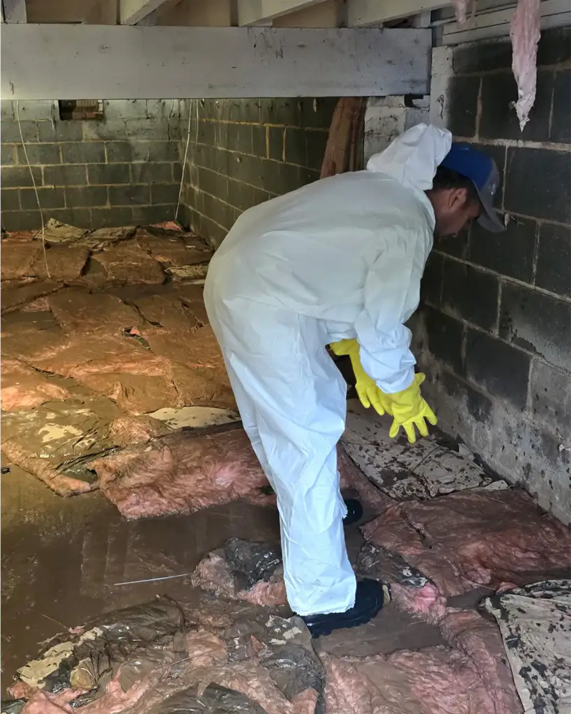
Pumping out floodwater and sewage, removing wet materials, drying, mold remediation and the rebuild, with asbestos work when older materials turn up. Condo and co-op boards can use our property management restoration service, and businesses on Mamaroneck Avenue or Fenimore Road can call on commercial water damage restoration.
- Water Damage Restoration
- Fire Damage Restoration
- Smoke Damage Restoration
- Storm & Flood Damage Restoration
- Mold Remediation
- Sewage Cleanup
- Asbestos Abatement
- Lead Paint Removal
- Reconstruction After Damage
- Commercial Water Damage Restoration
- Commercial Fire Damage Restoration
- Restoration for Property Managers
- Estimating, Appraisal & Expert Witness
- Remodeling
FAQ
Mamaroneck Questions
Where can I see my Mamaroneck home's elevation certificate?
If one is on file, at the village Building Department, 169 Mount Pleasant Avenue, 3rd floor. The village has been a Class 8 community in FEMA’s Community Rating System since October 1, 2014. Neither the Town of Mamaroneck nor Larchmont appears on FEMA’s October 2026 list of CRS communities.
Which utility serves Mamaroneck, and how are sewer backups kept out?
Westchester Joint Water Works supplies the water. It’s a non-profit public benefit corporation formed in 1927, whose members are the Village and Town of Mamaroneck and Harrison, based at 1625 Mamaroneck Avenue. Sewage runs to the county’s Mamaroneck Sewer District. In the unincorporated town, house connection lines must have a check valve to keep sewage from backing up into the home.
Which Mamaroneck streets and crossings are known flood spots?
In Ida, cars were stranded at Bishop and Fenimore in water at least waist high. The state’s river study calls for replacing the Station Plaza, Halstead Avenue, Tompkins Avenue and Ward Avenue bridges. In the unincorporated town, engineers list the Fenimore Road culvert, the Colonial and Homer Avenue area, Country Road, Myrtle Boulevard and Old White Plains Road, and the state adds Brookside Drive.
How close is Strongwater to Mamaroneck?
Very close. Our office at 111 Calvert Street in Harrison is about 2.2 road miles from Mamaroneck Village Hall on Mount Pleasant Avenue and about 2.5 miles from the Town Center on West Boston Post Road. The Mamaroneck River itself runs 7.3 miles from the Harrison and White Plains area down to Mamaroneck Harbor.
Nearby
Besides Mamaroneck, where on the Sound Shore do we work?
The village is split between two towns: part sits in the Town of Mamaroneck and the Rye Neck section in the Town of Rye, with the Mamaroneck River as the line between them. Larchmont is also in the Town of Mamaroneck, and Harrison, where we’re based, is upriver. We cover all of them; their pages are linked below.
Talk to Strongwater
Floodwater in your Mamaroneck home?
Call (718) 357-9191 for a crew from Harrison, just up the Mamaroneck River.